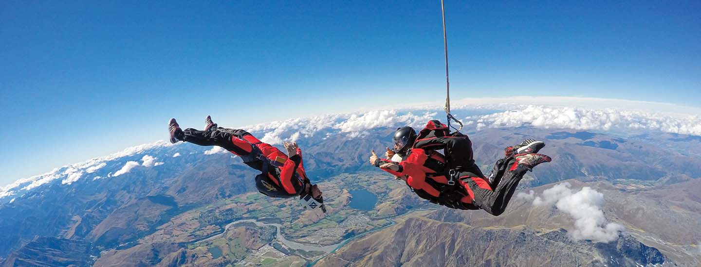
Skydivers enjoy the fall over New Zealand.

Courtesy of nzoneskydive, Queenstown, New Zealand

STANDARDS

Common Core: RH.6-8.1, RH.6-8.2, RH.6-8.4, RH.6-8.7, WHST.6-8.4, RI.6-8.1, RI.6-8.2, RI.6-8.4, RI.6-8.7, W.6-8.4, SL.6-8.1

NCSS: Culture • People, Places, and Environments • Science, Technology, and Society • Global Connections

GEOQUEST

Physical Map

Going to Extremes

From sandy beaches to snow-capped mountains, New Zealand’s many landforms make the country a top tourist destination.

Imagine climbing a volcano, jumping off the edge of a cliff, or sliding down a giant sand dune. You can do all that and more in New Zealand! The country in the Pacific Ocean has many types of landforms—natural features of Earth’s surface—including canyons, glaciers, and underground caves. Millions of people from all over the globe flock to New Zealand each year to explore, photograph, and brave those spectacular wonders. 

The country is an archipelago (ar-kuh-PEH-luh-goh), or a group of islands. The two largest are North Island and South Island—but there are about 600 altogether. The islands are part of a large landmass called Zealandia, most of which is underwater. Geologists believe Zealandia broke off from Antarctica about 100 million years ago.

Andrew Peacock/Cavan Images/Media Bakery

Climbers rest at the top of Aoraki/Mount Cook, New Zealand’s highest mountain.

Why So Many Landforms?

Experts say New Zealand has an abundance of landforms in part because it’s located where two tectonic plates meet. Tectonic plates are giant slabs of underground rock that make up Earth’s crust. Such plates constantly shift and crash into each other, producing landforms such as mountain ranges, geysers, and volcanoes.

In fact, New Zealand sits at one end of the Ring of Fire, a horseshoe-shaped area along the edge of the Pacific Ocean where 75 percent of Earth’s volcanoes are found. Mount Ruapehu and Mount Taranaki on North Island are two active volcanoes in the area that are part of the folklore of the Maori, New Zealand’s Indigenous people. According to legend, the two mountains were once married, but after an argument, Taranaki moved to the west part of the island. Ruapehu continues to send up smoke, it is said, as sighs for its lost love. Today, both mountains are top spots for skiing enthusiasts.

Tom Hoyle/Getty Images

Among New Zealand’s great adventures: rock climbing near Lake Taupo

Deep Thrills 

The nation’s river valleys are perfect for the extreme sport of bungee jumping, which originated in New Zealand. It involves leaping from a high point with one end of an elastic cord tied around your ankles. New Zealand’s highest bungee jump is more than 400 feet!

At the northernmost point of North Island, you’ll find Te Paki, home to amazing sand dunes. Some are more than 300 feet high. Farther south are volcanic landforms, such as bubbling mud pools.

Meanwhile, on South Island, visitors can kayak along narrow waterways called fjords (fyords), explore ice caves, or climb steep glaciers. In Queenstown, another popular spot for adventurers, you can ride a jet boat through a river canyon or hang glide from a 3,800-foot-tall peak. The city is appropriately referred to as the adventure capital of the world. 

It’s no wonder that tourism in New Zealand generates more than $16 billion a year in revenue, and directly employs more than 225,000 people.

Check out Map Skills Boot Camp for more geography practice.

glaciers

(n) large masses of ice that move slowly over land


The world’s largest glacier, which is in Antarctica, is more than 250 miles long, about 50 miles wide, and about 1.5 miles deep.

folklore

(n) the traditional stories, sayings, customs, and beliefs of a community that have been passed down from generation to generation


Bessie’s great-grandmother grew up in rural Louisiana and enjoyed sharing the area’s rich folklore with her family.

geysers

(n) natural springs that shoot columns of hot water and steam into the air through a hole in Earth’s surface


One of the most famous geysers is Old Faithful in Yellowstone National Park, which spouts hot water and steam 100 to 180 feet high about 20 times a day.

Indigenous

(in-DIH-juh-nuhs)

(adj) relating to people native to a particular place


Indigenous people lived in the Americas long before European settlers arrived, but those in the U.S. weren’t granted full citizenship until 1924.

mud pools

(n) hot springs filled with thick, bubbling mud


The gas-filled bubbles burst as they reached the surface of the mud pool, releasing a rotten-egg smell.

geologists

(n) scientists who study rocks and layers of soil to learn about Earth


Geologists examined soil samples to determine the best site to drill for oil.

valleys

(n) areas of low land between hills or mountains


The hikers rested at the top of the mountain, enjoying the view before heading back down the slope to the valley below.

canyons

(n) deep, narrow valleys with steep sides and usually a river flowing along the bottom


The campers’ voices bounced off the high rocky walls of the canyon, coming back to them as echoes.

Skills Sheets (2)
Skills Sheets (2)
Lesson Plan (1)
Text-to-Speech